
Kamakura is a scenic coastal city located just about an hour from Tokyo by train. Renowned for its rich history, serene temples, and laid-back atmosphere, Kamakura also boasts a variety of hiking trails that weave through its surrounding hills and forests. These trails offer the perfect opportunity to explore both natural beauty and cultural heritage on foot. This guide is designed to help international visitors easily and confidently enjoy hiking in Kamakura, with information on trail highlights, access, preparation, safety, recommended cafés, and useful resources.
Why Kamakura Hiking Is Special
Kamakura’s hiking trails wind through the city’s western, northern, and eastern hills. Each trail offers a unique blend of experiences: historical temples, scenic viewpoints, quiet forest paths, and seasonal beauty. From cherry blossoms in spring to vibrant foliage in autumn, Kamakura’s trails change with the seasons. Whether you’re seeking a peaceful stroll or a more physically engaging hike, there’s a trail for everyone.
Trail Guide: Routes, Maps, and Highlights
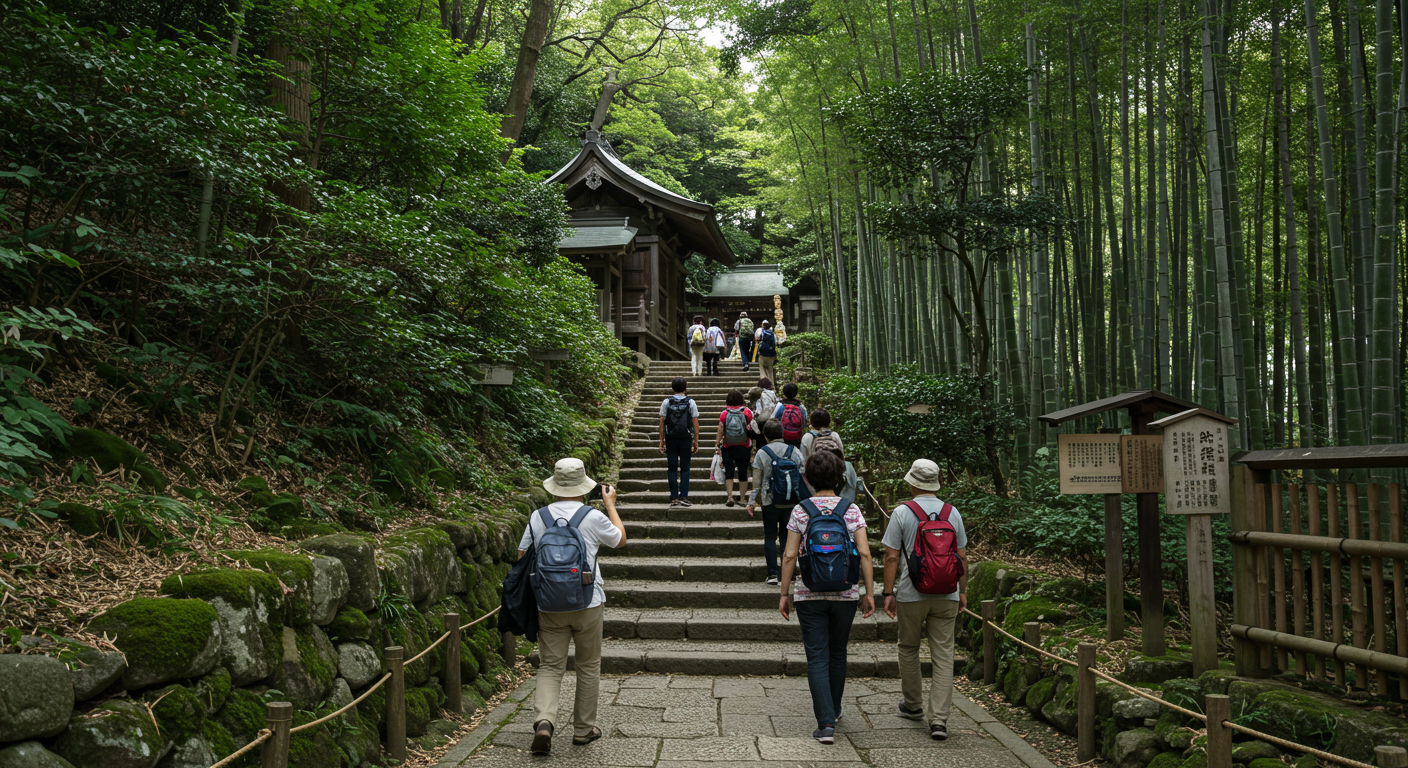
1. Daibutsu Hiking Trail (Ideal for Beginners)
- Start: Kita-Kamakura Station
- End: Kotoku-in (Great Buddha) or Hase Station
- Distance: 3–4 km
- Time: 1 to 1.5 hours
- Highlights: Jochi-ji Temple, Kuzuharaoka Shrine, Genjiyama Park (restrooms, vending machines), Zeniarai Benten Shrine, Great Buddha
- Map: Daibutsu Trail
- Nearby Café: Garden House Kamakura — Stylish café with terrace seating and locally inspired dishes near Hase Station
This trail offers a gentle introduction to Kamakura’s hills and historical sites. It starts at Kita-Kamakura and passes through temples and shaded paths, ending near the iconic Great Buddha.
2. Tenen Hiking Trail (For Active and Scenic Exploration)
- Start: Kencho-ji Temple or Zuisen-ji Temple
- Distance: 4–5 km
- Time: 2.5 to 3 hours
- Highlights: Kencho-ji, Shojoken Lookout, Mt. Ohira (highest point in Kamakura), Hojo Kubizuka, Zuisen-ji
- Map: Tenen Trail
- Nearby Café: Café Kaeru — Tranquil Japanese-style café near Zuisen-ji serving matcha and sweets
This ridge trail features rewarding climbs and expansive views of Kamakura and Sagami Bay. It connects two of Kamakura’s most important temples and offers a more demanding yet unforgettable route.
3. Gionyama Hiking Trail (Short and Scenic)
- Start: Yakumo Shrine (near Kamakura Station East Exit)
- Distance: About 1 km
- Time: 30–45 minutes
- Highlights: Lookout point, Harakiri Yagura cave tomb, natural trails
- Map: Gionyama Trail
- Nearby Café: Verve Coffee Roasters Kamakura — Popular café with quality espresso and relaxed vibes
A short and accessible hike offering great city views and quiet forest paths — ideal for a quick escape.
4. Asahina Old Road (Historic and Peaceful)
- Distance: About 2 km
- Highlights: Kumano Shrine, Asahina Falls, moss-covered stone pathways
- Map: Asahina Road
- Nearby Café: Café Yoridokoro — Relaxing seaside café near Zaimokuza with light meals and coffee
This lesser-known path retains the atmosphere of medieval Kamakura and provides a quiet, shaded walk.
5. Rokkokumiyama Trail (Nature Retreat with Views)
- Distance: Around 2.5 km
- Highlights: Rokkokumiyama Forest Park, Mt. Fuji viewpoint (on clear days)
- Map: Rokkokumiyama Trail
- Nearby Café: Kamakura 24sekki — Elegant café offering seasonal sweets and tea surrounded by nature
A calm trail ideal for forest bathing and a chance to glimpse Mt. Fuji from afar.
Maps and Trail Resources
Use online tools like Kamakura Hiking Map and Toshi’s Kamakura Hiking Map to plan your hike. These resources offer detailed English maps showing route difficulty, rest stops, toilets, vending machines, and attractions. Free printed maps are also available at the Kamakura Tourist Information Center near JR Kamakura Station.
What to Bring and Wear
- Comfortable shoes with good traction (trail shoes or sneakers)
- Layered clothing for changing weather
- Hat, sunscreen, and insect repellent
- Water and light snacks
- Offline map or paper map, phone, portable battery
- Small first-aid kit
- A bear bell (optional but common for wildlife awareness)
Getting There: Transportation Tips
- From Tokyo: JR Yokosuka Line or JR Shonan Shinjuku Line to Kamakura or Kita-Kamakura Station (about 1 hour)
- To Zuisen-ji: Take a bus from Kamakura Station East Exit bound for Kamakura-gu (10 minutes)
- Trailheads are usually well-marked and offer English signage
Rest Areas and Tourist Support
- Vending machines can be found at parks like Genjiyama and near Mt. Ohira
- Public restrooms are limited — check ahead using trail maps
- The Kamakura Tourist Information Center provides English assistance, free maps, and brochures
Safety Tips
- Trails may be slippery after rain — wear appropriate footwear
- Mosquitoes and hornets are active in summer — use insect repellent
- Stay on marked trails and follow signs
- Choose a trail that matches your fitness level and take breaks
- Check the weather forecast before you hike
- In an emergency, dial 110 (police) or 119 (ambulance/fire); for disaster messaging, dial 171
Final Thoughts: Experience Kamakura on Foot
Kamakura’s hiking trails offer a perfect mix of cultural landmarks and natural beauty, ideal for a day trip from Tokyo. Whether you’re following forest paths to a historic shrine or climbing a ridge for coastal views, each trail reveals a different side of Japan. Don’t forget to enjoy a local café afterward and reflect on your walk. Put on your walking shoes — Kamakura’s hills are calling!


コメント